5 Factors that Make Up Grand Canyon's Unique Landscape
Learn the secrets behind the formation of Grand Canyon. Explore the role of the Colorado River and its tributaries, discover the surprising mechanism of erosion, and understand how modern-day aridity shapes this natural wonder.
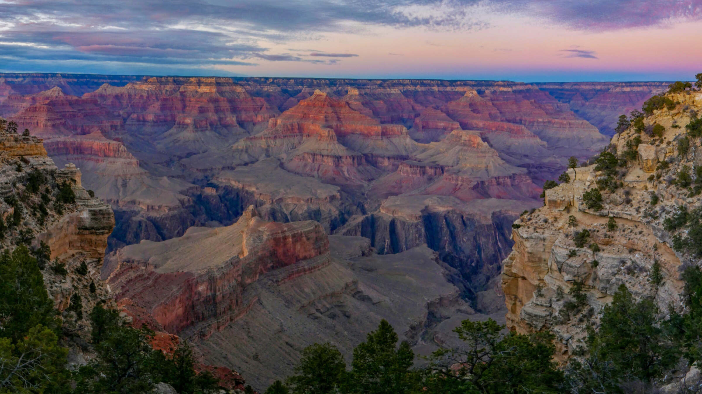
One of the most frequently asked questions at Grand Canyon National Park is, “How did the canyon form?” If only the answer was as straightforward as, “The river did it!” And while that is mostly true, there are other contributing factors at play - and you don’t need to be a nerdy scientist to appreciate these. Let’s dive into the key factors that created one of the world’s seven natural wonders:
The Role of the Colorado River
First, the Colorado River is responsible for Grand Canyon. The river begins in the Rocky Mountains at 14,000 feet and flows about 1,500 miles before reaching the sea in the Gulf of California in Mexico. But the river alone cannot completely explain the size and shape of the canyon, since it was assisted in its task by the hundreds of tributary streams that enter the main channel.
Let’s Talk Tributaries
While the Colorado River may have etched the canyon one mile deep, it is the tributary streams that make it (on average) 10 miles wide. That is why instead of saying ‘the Colorado River carved Grand Canyon’, we could more accurately say that the Colorado River is responsible for Grand Canyon.
What Do Rocks and Glaciers Have to Do With Grand Canyon?
How did the river and its tributaries carve their path? The answer may surprise you since it is not the water that did it, but rather the rocky debris eroded and transported in floods that does most of the cutting. Think of this flood debris acting as a giant rock tumbler that can physically abrade the bedrock channels. In the last two and a half million years, repeated cycles of glaciation in the Rockies caused huge Ice Age floods to roar down the river. As the river deepened its track in Grand Canyon, the tributary streams kept pace as their load of more and bigger debris incised into the bedrock.
We Can Also Thank The West’s Arid Environment
Lastly, all of this geology and hydrology is set within the arid environment we associate with the southwest today. This allows the colorful sedimentary layers that make up the walls of Grand Canyon to be beautifully exposed and not covered in vegetation or weathered slope debris. If one could take everything about the canyon and put it in a tropical environment, the result might be a deep valley, but it would look nothing like the colorful defile we see today.

Five contributing factors then make up this globally unique landscape:
An expansive stack of flay-lying sedimentary rocks;
These rocks are variably and brilliantly colored;
All gently uplifted en masse to high elevations;
That become incised by a large river and its tributaries;
And all set upon an arid landscape.
Remove any one of these and the Grand Canyon would not exist as we know it. This is how the Grand Canyon formed.
About the Author
Wayne Ranney
Wayne Ranney is a geologist, author, and river guide living with his wife Helen in Flagstaff. During his nearly fifty-year career as a guide and teacher, he has mentored uncountable fellow landscape enthusiasts. Among his ten books are the award-winning Carving Grand Canyon, Ancient Landscapes of the Colorado Plateau and Sedona Through Time. He is a co-editor and contributing writer for Grand Canyon: Monument to An Ancient Earth.
Written by guest author Wayne Ranney.
Ancient Landscapes of the Colorado Plateau
A groundbreaking book featuring the geology of the American Southwest in a way you've never seen it before! Authors Ron Blakey and Wayne Ranney.
